Saturday, 4th of September, 2010
Ben Vane - Beinn Mheadhain - "Middle Hill" - 915m - (Munro)
Ben Vane facts!
Another of the Arrocher Alps. The bealachs with the other peaks are very low so Ben Vane is normally climbed on it's own.
This set of hills are believed to have their own ghost - a man with bowler hat and umbrella... we didn't see him.....
The route passes Loch Sloy which is an old name in Scottish history. The mountainous region at the head of the Loch Long, bounded on the east by Loch Lomond and on the west by Loch Fyne, may be said to have formed, back in the dark ages, part of the boundary between the kingdoms of the Scots, the Picts, and the Britons of Strathclyde.
The UK's largest conventional hydroelectric power station, Sloy Power Station, is located, near Inveruglas at the start of this walk. It takes water from Loch Sloy through four large pipes down the mountainside giving a working height of 277 metres.
A beautiful day for walking, sunny but a good breeze.
This was Braxony's 10th Munro - hurrah!

Braxony were joined on this walk by Simon & Emma. We began by following the path beside the A82 southwards from a carpark just outside of Inveruglas, passing the giant pipes running down from Ben Vorlich, (shown above), which drive the turbines of the Inveruglas hydro-electric power station. After almost a kilometre we turned right onto a tarmac road leading under the railway. Soon after this we passed a large electric substation on the left. The steep slopes of Ben Vorlich towered on the right, whilst the more elegant summit of A'Chrois was on the left, rising above a dense blanket of forestry. Ahead was Ben Vane itself, a rough, rocky pyramid of rock and grass. Once beyond Coiregrogain the tarmac road curved round to the right, heading to the Loch Sloy dam - another part of the hydro power scheme. Here we turned left onto a forestry road, crossing a bridge over the a river and running just to the right of a plantation. Four hundred metres beyond the bridge, we left the track and followed an initially unclear and rather boggy path. The path soon began a slightly boggy ascent, which reached a low shoulder at the foot of the ridge that lead up to Ben Vane. We crossed the shoulder and followed the path that soon began to climb directly up the mountain. The path was steep and eroded in places. Excellent views soon opened up behind us over the forestry and Loch Lomond beyond. There was some interesting scrambling on the rocks on the way up, (which only after did we realise was optional). Higher up the ridge became better defined. There were several false summits before we actually reached the real top of Ben Vane. The view is given great depth by the shape of the mountain, but there are higher peaks all around restricting the panorama. The views were nevertheless beautiful.

The Summit!
 Jackson tucking into his tiffin
 Braxony tenth Munro - high five!
Simon and Emma - showing Braxony how it is done.
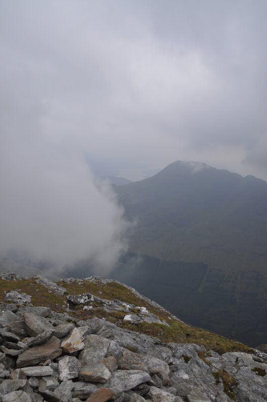 The views

Starting the descent the same way we had come up.

 Loch Sloy
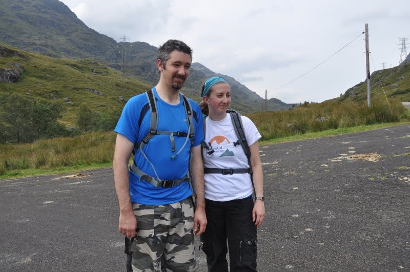
Simon & Emma having descended
 Braxony with Ben Vane in the background.
Numerous pylons and the power station


Caterpillar - still to be identified

Simon's special socks

Chaffinch